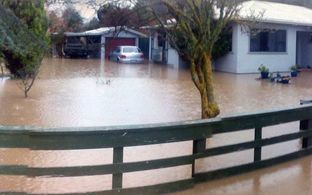
The Reweti whānau home during flooding in 2015. Photo: Supplied via LDR
A Whanganui resident says flooding danger in the riverside marae community of Pūtiki is a tragedy waiting to happen.
Lisa Reweti lives with her parents Simon and Carolin in Pūtiki Drive. Their home has been flooded four times in 20 years and there have been countless close calls.
Floodwaters have also hit the neighbouring kaumātua flats and other homes, forcing late-night evacuations over the years with some needing to be carried to safety.
Reweti said the flooding was partly due to the Ngatarua Stream rising rapidly after heavy rain.
“Over the road is a tragedy waiting to happen. When it’s in full flood, the water is over six-feet deep. If anyone slipped in there, they would be sucked into the culvert and gone.
“It’s dangerous even when there is no water. The banks around the culvert are collapsing. We have whānau going into the culverts desperately trying to clear them out.”

Reweti said the community needed urgent action from Whanganui District Council, Horizons Regional Council, and Waka Kōtahi to minimise the flood risk.
Reweti said she had contacted the three organisations numerous times, only to be passed from one to the other with no satisfactory response.
“We’ve had huge difficulty. We would call one of those places, they’d pass us on to another one, and we’d just go round and round and round in circles.”
Reweti said ruined carpets, walls and furniture and days of chaos and cleaning follow the worst flooding, leaving the whānau anxious and stressed at any sign of rain.
“We’re incredibly anxious every time it rains. The first lot of flooding in Auckland was really triggering for us – because we’ve been those people who are up at two in the morning in the pouring rain, trying to evacuate kaumātua, trying to get our stuff out of the way of the water, seeing the water rise really quickly.”

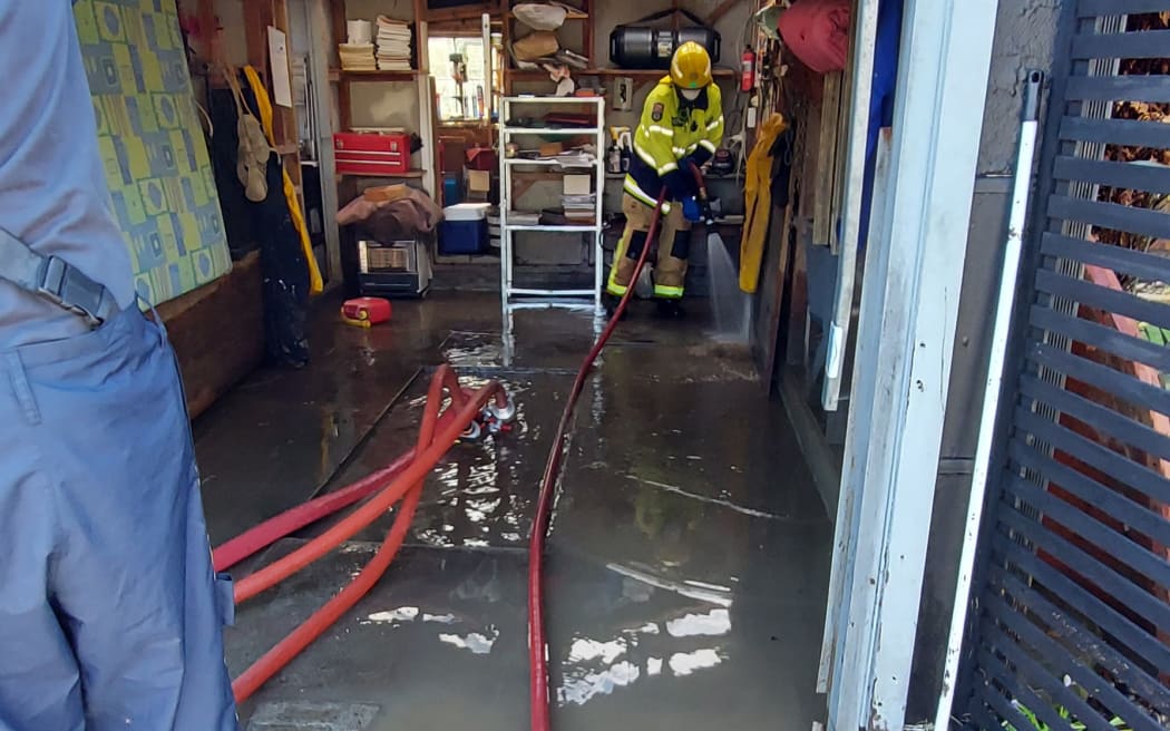
Emergency services pump out the Reweti whānau home’s garage in 2021. Photo: Supplied via LDR
It was not until Reweti copied television consumer watchdog Fair Go into an email seeking answers that the councils responded, she said.
Three weeks ago, Reweti discovered a Catchment Management Study on the Ngatarua catchment, commissioned by the Whanganui council in 2003 and completed in 2004, made recommendations to reduce flood risk at Pūtiki. It appeared the report had been left to gather dust.
Reweti emailed the councils and Waka Kōtahi to ask what actions had been completed as a result of the report, copying in Fair Go. The television programme contacted the three organisations.
Within the week, the councils had arranged a meeting between the whānau and engineers from both councils. A trustee representing the kaumātua flats and other property owners on Pūtiki Drive also attended, along with a Massey University ecologist from the Deep South Challenge research programme on climate change adaptation.
“We did not even know that a team of academics and scientists from Massey were trying to help us,” Reweti said. “To be able to make decisions concerning our property, we need to have all the information.”
Reweti said Pūtiki lies on a floodplain between a swamp and a river, but the councils and Waka Kōtahi could do a lot to reduce flooding risk.
The 2004 report by Opus showed the natural path of the Ngatarua stream was changed 60 years ago.
“In 1962, the Cobham bridge was built. A new road was built to connect the bridge with the state highway. This split the hapori of Pūtiki in half,” Reweti said.
“The Ngatarua catchment was diverted. Its true path goes across the state highway into Wikitoria Road and then it slowly meanders down to the river mouth where it flows out to sea.
“The creek needs to be put back on its natural path. That means Waka Kōtahi would have to dig a tunnel under the state highway.”
The road in front of the whānau home had also been built up too high, Reweti said.
“It’s trapping the water in our property and the kaumātua flats. If Waka Kōtahi sliced the top of the road off, lowering it, that could minimise flooding.”
The report said a further issue was the channelling of stormwater from properties on Durie Hill to the modified Ngatarua Stream when it was unable to contain “all but the smallest rainfall events”.
The 2004 report describes Pūtiki Drive as acting as “a retention dam”. It said the Pūtiki Drive culvert was too small, limiting the volume of water that passed downstream, and houses on Pūtiki Drive were up to half a metre below the built-up level of the road and “would suffer widespread flooding”.
Reweti said clear recommendations for mitigation were made 20 years ago but none of the work had been done.
Waka Kotahi looking at possible solutions
Waka Kōtahi acknowledged Rewiti’s concerns and told Local Democracy Reporting it had been working with the whānau to understand the problem and potential solutions.
Waka Kōtahi maintenance and operations system manager Rob Service said a possible long-term solution would require a multi-agency approach in partnership with local territorial authorities.
“An investigation is currently looking at assessing whether the current culvert needs upgrading to a larger size, what the downstream effects would be if this is undertaken, and we anticipate this to be finished toward the end of the month,” Service said.
“As an immediate response, we have spoken to our contractor Higgins to inspect the culvert and clear as appropriate.”
Service said while an appropriate long-term solution was considered, the culvert would be cleared quarterly rather than annually.
The councils have offered to immediately check and clear sediment from the creek.
Reweti said improved stream flow would reduce the risk of flooding and the councils were also working on longer-term plans, including funding riparian planting.
Meetings would be held every few months to keep residents updated, with the next scheduled for mid-May.
Local Democracy Reporting is Public Interest Journalism funded through NZ On Air